Trek A: Ramelau Mountain circuit
| Ramelau Mountain circuit Four wheel drive (4WD) tracks in East Timor are almost always only used by people or horses. All bearings provided in the trek guides are magnetic, direct from the compass dial.A pack horse is useful for carrying your gear up to Mt Tatamailau and along the ridge as far as Mt Deramalue. Beyond this the terrain becomes too difficult for a horse.Start at Hatobuilico police station. You should provide the police with details of your trip and return plans. Ask them to inform the Ainaro police of your expected arrival time there.
HATOBUILICO TRANSPORT Walk back about 100 meters and turn left. Then head uphill along a broken bitumen road at 230d between (on the right) a wooden house and (on the left) a solid concrete house. Further uphill turn around for good views to the left.. The view back to Hatobuilico is in line with the steps of the pousada, the old restored Portuguese district administration building. Up to the right is Mt. Tatamailau, at 280d. Continue on into a clearing at an altitude 2310 meters. where a religious monument to the patron saint St Francis, saint of ecology has been erected,this is the limit of vehicle access. Walk through an arch and follow the 1000 plus steps uphill onto a smooth gravel track, Zigzag uphill for less than half an hour then on the left, is a well made one meter wide fairly level path that sidles around (follows the hill around staying fairly level) with a fall on the left. This is the easy constant grade route to the mountain top; provided there have been no recent landslips. The direct steep route continues to the right at 320d in a direct line to the mountain to where the track starts to disappear, then zigzag steeply up cow paths, aiming to intersect the ridge approximately 200 meters south of the mountain top. Turn right onto the ridge and walk north along a well formed 4WD track to the summit. Walk east uphill on the easy well formed path that is cut into the hillside with the fall away to the left, for little over a kilometer This track was constructed in 1997, there is then a sharp right switchback. Don’t take this, but continue straight ahead down onto a grassy saddle this is where our track meets the spine of the mountains and is a good lunch spot. 8,54’52.00”S 125,29’31.18”E altitude 2777.) Leave packs here for the easy walk up to and back from Mt. Tatamailau. Tatamailau summit walk If walking to Tatamailau, backtrack north-east for 30 meters to the switchback. Veer left and walk up a gentle gradient past some hollow tree stumps stuffed with rocks on the left. These are marker cairns. This track leads on to a small plateau among grassy hillocks and gnarled, large eucalypts. In a clearing 400 meters from the lunch spot is a small thatch roof church.(This could be used as a refuge in an emergancy). Walk up a well-formed 4WD track for half an hour following a gentle ridge slope on a bearing of 40d. This is an easy walk to the highest point in Timor 8,54’23.29”S 125,29’36.22”S 2986 meters. The religious monument on top is very exposed with magnificent 360d views. Many people come here to see the sunrise. Retrace the track back to the packs, along the backbone of East Timor. The watershed on the right goes to the north coast and the one on the left to the south coast. High ridge walk to camp site With packs set off south west along a well-worn path. Up at first, then up and down along the ridge which is the roof of Timor. After crossing a rocky saddle, ignore the track straight ahead and go slightly downhill at 200d along the razorback ridge. The town of Asabe is visible 1500 meters below to the west. Climb up to the top of Mt. Deramelau. The views from here are superb, including back to Tatamailau and on to the route ahead along the tops of the mountain chain. 8,55’08.43”S 125,29’10.04”E altitude 2819 meters. The razorback limestone ridge ahead at 240d ends abruptly at an impassable cliff, so backtrack 100 meters and go steeply down at about 300d to get below the level of the bottom of the cliffs. When down to this level turn left and sidle along level with the base of the cliffs, which are on the left. Travel south among large boulders fallen from the cliffs above. Then scramble back up onto the main ridge with the impassable cliff on the left. Turn right and proceed along the ridge at 240d . To the left and below are vegetable gardens and small huts. Straight ahead to the south is Mt. Hatofahi, an abrupt razor-backed conical shaped limestone mountain. On reaching the base of Hatofahi take the right track that sidles level along the north-west side of the mountain, with the cliffs above to the left of this well-used track. Once past this obstacle walk up past the top of vegetable gardens and back onto the main ridge. Follow the ridge south-west down to a saddle to cross over a well-used track (the map does not show the cross track, only a district boundary going down to the south-east.) The route south-west to the rounded top of mount Laumeta is through exposed stunted eucalypt scrub. Then follow the ridge south-west, and south down to a saddle with a track going across it. Straight ahead to the west is Mount Berebei. We camped in the valley to the north-west and were able to get water from the small creek. (All creek water in Timor needs boiling for a few minutes, or some other means of treatment to make it drinkable.) HOME SWEET HOME I had intended walking the five kilometers over Mt Berebei, along the spine of mountains south-west over Mt Lebolia and Mt Ramelau, then east off the main ridge and south-east down to Ainaro. However after walking over Berebei, and downhill along the ridge, on a track through beautiful open woodland we reached a cliffy area in foggy conditions. The Timorese guides, who had not traveled along this particular ridge before said the route ahead is too rough and dangerous to travel in these conditions. So we backtracked to Lebolia and then Berebei saddle, turned right and headed south-east down toward Ainaro.(If you manage to walk the five klm steep section please take notes and forward them to me and I will include them in these trek notes.) Ridge to overnight stay in AinaroFrom this saddle a well-used track heads downhill and south-east into open woodland. Continue across a saucer-shaped valley, passing on the left a small freestone wall and many dead ring barked gum trees. This valley drains through a gorge on the right.Leave the valley just above and up to the left of a saddle. Walk east down through vegetable gardens and fallen trees. Ahead on the left is a small plateau with a thatch house on top. |
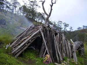
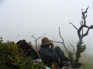
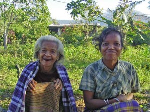
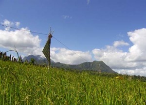
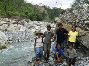
WAIT FOR FOG TO LIFT We pass down below and to the right of this. The track leads up to the east edge of the plateau, where on the right is a house with a stick protruding 300mm up through the apex of the roof. The residents have barking dogs.There are fantastic views here, east down into the deep valley of the Belulie river, and across to the very culturaly significant Cablaque mountains. This rugged limestone range is geologically quite young at five million years. Turn right along the ridge: the track then sidles along with the fall on the right (the main ridge diverges away to the left.) The track crosses rolling farmland to the south-east edge of the plateau. At a large tall eucalypt on the right that has survived ring barking, the track drops steeply along a spur through a forest of large eucalypts. There is a very steep drop-off on the left and occasional huts in the forest to the right. We stopped for lunch beside two thatch huts on a small terrace on the right side of the track, altitude 2345 meters Approximately one kilometer down, the track emerges into well-grazed grassland. Due to environmental damage by grazing animals there is no single distinct track (and my compass was broken). Walking downhill with the afternoon sun on our backs we crossed a 100mm dia galvanized water pipe, walking in eroded cattle ruts, going east-south-east with Ainaro visible off to the right. From here on down to Ainaro this pipe is occasionally visible to the right and at times left of the track. The track takes a sharp right turn and then passes a cave up to the right. The pipeline goes through a small concrete reservoir. Follow the pipe across a small creek and onto an old dirt road cut into the hillside, with the fall away to the creek on the right. Then follow the road down under a bamboo aqueduct. This is Berluli. After the first few houses there is a bamboo water outlet on the left, a good place for a wash. The road is now sealed but there are no signs of motor vehicle use. On the left is an unusual house roof, tiled with split bamboo. The view straight out left is Cablaque Mountain, ahead and to the right is Ainaro. Pass to the left of a Telcom tower and down to meet the Ainaro–Dili road. Turn right and follow this down across the river and up into Ainaro. AINARO GREAT GRANDMOTHER AND DAUGHTER For the overnight stay there at least three guest houses to choose from. The easiest way to locate them is to ask at the police station. At the same time inform the police that you have walked in from Hatobuilico. I enjoyed an excellent meal at the restaurant below the central market,on the left side of the main road. Ainaro to Hatobuilico In the main street of Ainaro just above this market catch one of the regular long distance buses or some other vehicle. Travel twelve kilometers toward Dili = north-east, to the hamlet of Lepulau. This is where the river draining the Hatobuilico valley crosses the highway. ONE OF A CHAIN OF BIRD SCARES (If some of the directions seem a little imprecise this is because my compass broke on the way down from the mountains. However the walk ahead is not difficult.) Start by walking up behind the school 8,56’28.09”S 125,32’29.00”E and past and to the right of a small concrete water reservoir, then up into a forest of casuarinas with an understory of coffee plants. The river is about 100 meters away on the right and slowly diverging away to the right. The track comes out of the bush, turns a bit to the right, passes between two fishponds and under a bamboo aqueduct, then starts to climb steeply to the left. At a T intersection (there is a house just visible on the steep spur to the left) turn right. A waterfall is visible about a kilometer away on the right. The track goes up into more casuarinas, emerges into the open and immediately crosses a 4WD track. Walk up the steep foot track (crossing the 4WD track a few times). When you are on the narrow spur, pass to the right of a rocky creek and small cemetery on the left, then climb up onto a bench cut into the hillside. There is a corrugated iron building on one side, and a limestone monument on the other. 8.56’06.00”S 125.31’32.00”E Elevation 1530 meters) The view over the hamlet just right of the cemetery looks out over Ainaro all the way to the south coast. Leave via the opposite corner of the plateau. Go down about 30 meters, cross over a small dry stream, turn right and continue uphill parallel with the rocky creek off on the right. Aim for a saddle visible steeply up ahead. This track crisscrosses a grassy 4WD track, then levels out a little with about six houses and some farm dams away to the left. The track leads north to cross a saddle to the left of Mt Sisalio which is up ahead to the right. From the saddle follow the 4WD track down to cross a flowing creek. Head north-north-west. Either follow the road or take a short cut to the right of an earth dam and up along a well-used foot track to rejoin the road at an eroded saddle two kilometers south of Hatobuilico. At the start of town on the left at the base of a huge 100 meter high limestone rock is a spring-fed water reservoir, with drinkable water. Please sign out at the police station. RIVER CROSSING AINARO The above trek is of medium to hard difficulty. In these mountains beautiful sunny conditions can quickly turn into heavy fog. You can rapidly become lost and get into serious trouble. This is one of the main reasons why it is so important to have a guide. Note: this trek guide was written in Australia from notes taken during a trip in June 2004. It should be taken as an indication only and common sense should be used at all times. The author welcomes any corrections to update this information. |

RAMALAU MOUNTAINS

