Trekking Maps
Trekking Maps
Timor Leste is North West of Australia, less than one hours flight from Darwin.
Try a virtual visit to the Trek and Cycle routes of Timor Leste on Google earth.
(There are some coordinates in the Trek and Cycle notes.)
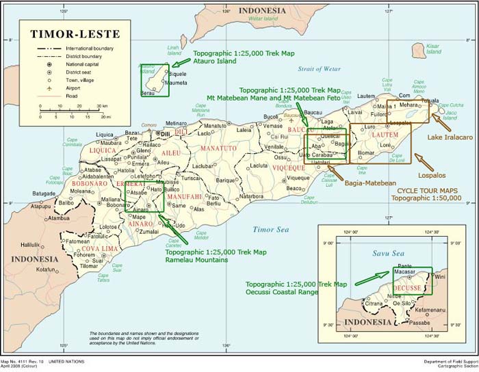
Detailed 1-25,000 topographic colored poster size double sided maps clearly showing each of the treks are available.
Map A= Atauro Island +Mt Matebean.
Map B= Ramelau Mts+ Oecussi Coast Range
Plus 1-50,000 topographic maps, showing the parts of the cycle tour that require detailed information.
Map C= Bagia+Lospalos+Lake Iralalaro
These can be purchased in Australia by mail from
John Bartlett tuesdayhometime@hotmail.com
Any profits from the map sales will be used for guide training and revegetation works in remote areas of Timor Leste.
