Ride D: Viqueque Baucau Vemase
|
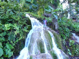
Zero trip meter and ride uphill through the roadside markets. The south coast road branches off to the left at 8.52’00,66”S 126.21’55,00 S” near the top of the old town at a strange hexagonal Indonesian built monument that seems to be dedicated to the multinational sporting goods manufactures. At one kilometre an old Portuguese building is above the road on the left then it cuts into the hillside in the bush overlooking the river, at 2 klms you are in the new part of the town called Beloi where you will find most of the restaurants and guest houses,The Timor Telcom building with the tower behind has a couple of computers and a slow internet connection. WAI LAKU RINI WATER FALL Ride north, there are spectacular views from some of the bridges down into the river gorges. The scour line gives some indication of the volume of water that surges down in the wet season. Loihuna at 15klms has a spectacular waterfall that cascades out of caves on the high side of the road, and a fish farm below. Just ahead on the right is a turnoff that leads 700mtrs up to the Wai Laku Rini , Timor Village Hotel. 6.46’50,27”S 126.22’32,92”E. This is an attractive large old house in a beautiful setting with spectacular views , and the beer is cooled by a mini hydro powered refrigerator , food and service are excellent. At night you are lulled to sleep by the distant sounds of an occasional truck or bus winding its way up the mountains . There is a pool in the river for swimming. “ It is the perfect place for a break to wind down near the end of the ride.” A guide from the hotel can take you on a motorbike, or a two hour walk up to the Lekiraka cave laberenth. The entrance is at an elevation of 400mtrs, the waterfall by the road is at approximately 200mtrs and it is probably part of the same cave complex. “It is definitely worth a visit.” JAPANESE WW2 MUNITION STORE The pass over the dividing range is at an elevation of 1000meters, so if the 800 meter climb is too much , flag down a bus or truck and ride to the top in comfort, and it is an interesting cultural experience if you can talk your way into riding in the cabin with the driver and his assistant. “ They really are the “kings of the road” The driver will not stop where the road is narrow or climbing a steep hill, and they won’t stop for a raised arm, to flag them down you have to actually wave your hand up and down with the hand facing down. “ Negotiate the price before boarding” |
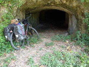
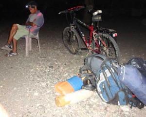
The mountain town of Ossu with a colourful market, interesting catholic school and the Waida Monastery is passed at 35 klms. On the climb out of Ossu the high mountain 5klms to the west is Mundoperdido, it was here in 1986 that Xanana held peace talks with the Indonesian Military. The mountains around here were a hideout for the Falintil guerrilla resistance. There is a small roadside market on the right at the top of the final climb to Mt Depauta on the top of the dividing range, on the left is a transmitter tower with hakmatek written on the concrete wall .38 klms 8.42’00,00”S 126.22’04,54”E. Venilale junction is at 48klm 8.38’37,80”S 126.222’34,00”E and the main part of the town is a kilometre to the east with a brightly painted old school interesting church and the hot spring of Uaicana is in the area. Ride north on the Baucau road. This exhilarating mostly downhill ride is through lush terraced farmland with the sacred Matebean Mountains jutting up on the skyline to the east. On the left at 51klms a Japanese munitions storage complex has been excavated into the roadside by forced labour during WW2. At 58klms on the left is the turnoff to the Fatumaca agriculture college that can be seen on the hill. PSA. On the outskirts of Baucau Turn off sharp to the left opposite a cemetery at 71klms, and 1klm up to a roundabout, the Baucau bus station and upper town market, There is a café by the SE side of the roundabout. 8.28’44,21”S 126.27’09,62”E. Ride north up the hill and past a water tower it is now a fairly mundane ride across the limestone plateau. There is a T intersection at 76klms right leads to lower Baucau. TL. The airport gate is at 80. TR . The road loops around the end of the runway and heads west off the plateau. The ride down to Vemasse on the coast winds through bush and agricultural country, it is a fantastic way to finish the journey. Vamase at 99klm has a pier and roadside cafes. It is 9klms further west to the Vamase village and river. Long distance busses pass through here in the early morning, generally between three and five AM ,so you will need to get out onto the road and flag them down with a torch. Trucks pass through the day ,so you will probably be able to get a ride back to Dili on one. They generally charge a little more than the bus fare if you have a bike, settle on a price before loading. ” May the wind be on your back” EARLY ROADSIDE BUS WAIT |


