Trek B: Matebean Feto
| For information about the region (including Baguia and Uaiboro), access to the walks and organizing your trek, see Matabean Mane. This day walk commences at Uaiboro and goes over the high plains to climb Matebean Feto, ending at Baguia.The route out to Matabean Feto is shown on the map as a solid red line, the route back to Baguia as a broken red line.The guide for this trek was Lucio Freitas Salvador from Baguia the second guide was Joao De Oliveira.
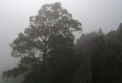
Uaiboro to Mt Matebean Feto summit Start from the north-west corner of the village of Uaiboro. The well-defined track climbs gently north-west with a fall away to the right, then heads north and becomes fairly steep. Locals under Japanese forced labor constructed this track. It then swings north-northeast up against the steep face of Matebean Mane. Climb over a cane fence onto a small saddle and rocky knoll. Altitude 1457 meters. Head downhill on the formed track. Soon the track levels. When you enter a small patch of rain forest, leave the formed track, go to the right and walk downhill in short grass. On a bearing of 40d this route leads down to cross a small creek flowing away to the right. Cross and climb up a muddy grass hill at 30d, on the right is the head of a deeply eroded tributary of the creek. Look back: there is a prominent 10 meter high pyramid-shaped limestone rock. Continue to zigzag up using eroded cattle pads. Once on the open grassy ridge turn a little left and follow it north at 340d. This leads to an area of old bomb craters and limestone outcrops. Continue walking up and cross a well-worn track. This is the main track connecting the upper farming area just south of Matebean Mane with Quelicia, a village down in the valley to the north-west. Then climb over a limestone fence between outcrops amongst many eroded bomb craters; to the top of the ridge Elevation 1709 8,37’42.52”S 126,36’45.74”E This is Mount Labalou. This is an old Indonesian military campsite. There are old latrine pits and other signs of a major military post. During the Indonesian invasion Falintil guerillas would make night attacks here. Many fleeing Indonesians, unfamiliar with the area, ran off the cliff tops to their death. Joao De Oliveira, one of the two guides, walks barefoot and speaks no English. He has an amazing knowledge of the terrain, as he was a guerilla fighter in this area. Fighters fall into three groups: Falintil, who carried guns and arms.; Arma Branka, using Katana and Dima (machete and spear) and OPS, who used Katana and Tudik (knife). The last two groups also supplied, fed and gave information to Falintil. Joao was Arma Branca. When he stops he often chants, asking for the clouds to clear. Due to the low cloud and drizzle during our trek the visibility for the day’s entire walk was about 30 meters maximum, so Joao had very few landmarks to navigate by. It would be extremely difficult and foolhardy to try to walk this area without someone like Joao to guide you when the cloud comes in. From this high point proceed down hill at 350d with the fall on the left. About one kilometer down you will reach a saddle. There are lots of deep eroded cattle pads. I realized this must be like a pass where animals are funneled in, to get between the northern and southern grazing areas. A little off to the east is a large fluted limestone outcrop with an attractive alpine pine growing beside it. This rolling grassland is overgrazed and eroding. In the fog we could often hear and catch a glimpse of horses and cattle. From here continue downhill in the same direction and cross a small creek. Then using cattle pads climb up onto a saddle immediately north-east of Matebean Feto. The route meanders around a bit to the right and left of a direct line.Matebean Feto towers above this saddle. On cattle pads the twenty minute climb zigzags up the very steep slope on a bearing of 204d among limestone boulders, then crosses the ridge just north of the summit, and the final 50 meter scramble is approached from the northwest. (Top of Mt. Matebean Feto. 8,36’57.10”S 126,36’11.25”E altitude 1963 meters.) |
Mt Matebean Feto summit to Baguia Retrace the route down to the saddle fifteen minutes away, continuing in this direction with a fall away to the left. The mountain shown on map as 1849 is on the right. The route curves right between this mountain and the one shown as 1871. It is two kilometers from here back to Mount Labalou. The route then follows well-worn tracks a little to the east of the route out on a bearing of about 150d. It then leads down over the stone fence to the well-worn Qeuelicai cross track. Turn left and follow this Japanese track gently downhill, with the fall on the left approximately east. At about two kilometers from Mount Labalou the way passes between two earthern farm type dams. These are fed by a spring up to the left where you can fill your water bottle. Many Lospalos people were massacred by Indonesian bombs at the site of this important water supply. The track soon climbs over a rock wall. Apart from the first 20 minute morning climb up from Uaiboro most of the walk to this point is over open rolling heavily grazed grasslands. We saw no other people or buildings. The well-used track now starts to drop off the high plains into steep rocky vegetable-growing farmland. This area is known as Ossulari. The now rocky and sometimes gravelly track continues down south-east for another couple of kilometers to end at the Ossohuna–Baguia road. The last few hundred meters are on a ridge that is open and extremely steep. The track zigzags on loose gravel and when wet is quiet dangerous. To tumble or roll forward would be disastrous. On these extreme, descents the Timorese suggest to keep your knees bent as this absorb some of the shock load on your legs, and when stepping forwards take your weight onto your heels, so that if you topple forward you have a chance of rebalancing with your toes. Turn left onto the bitumen road and walk north-east 3.5 kilometers back to Baguia. This walk takes about eight or nine hours including breaks. On the day of our walk there was a heavy cloud cover and visibility was down to 30 meters maximum, so the route I have written will only be approximate. There are many other routes over the high plains up and down from other directions. I believe the views from some of these walks are magnificent. My mobile phone was getting reception via Baucau from the top of Matebean Feto and Matebean Man SUMMIT MT MATEBEAN FETO Trek difficulty : medium to hard. In these mountains beautiful sunny conditions can quickly turn into heavy fog. You can rapidly become lost and get into serious trouble. This is one of the main reasons why it is so important to have a guide. Note: this trek guide was written in Australia from notes taken during a trip in June 2004. It should be taken as an indication only and common sense should be used at all times. The author welcomes any corrections to update this information.
|


