Ride B: Com Jaco Island Lospalos
| The people of Lautem district, which is the whole of the eastern end of Timor, speak Fataluku a Papuan language, and very little else. Bahasa Indonesian is probably the most practical way to communicate. Ride back to the Com resort, T L and zero trip meter. The broken sealed road (passable by a 4WD or high clearance truck) heads SW uphill through Petileti village with a hard climb of nine klm to the edge of the plateau at 490 meters above sea level. The bush is stunted as the Indonesian military sprayed defoliants and forced the locals to clear the area to restrict the operations of the Falintil guerrilla fighters. 1.5 klms further on is an interesting animist grave on the left. PSA.The main road to Tutuala is reached at 12kms. 8,26’38.50 S 127,00’21.00E. T L. and ride east through Bauro on the narrow bitumen road, pass two uma lulik (traditional raised spirit houses, on the left). At 14.6 kms is the house of Fernando Rosales.
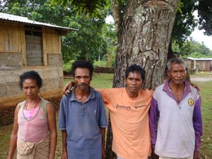
RIGHT FERNANDO CULTURAL CUSTODIAN He is a traditional judge and a caretaker of the culture and history of Lake Iralalaro and some of the local caves and underground lakes. He only speaks Fataluku and a little Tetun. His house is on the left with a satellite dish and coconut tree on the west side and a shed under a mangrove tree on the east, and in front of the house the road crosses a pipe culvert with “cup dream” written on the end wall. He may wish to show you some of the caves in the area, with the possibility of an underground swim.
CAVE SWIMMER ILALAFAI Ride east to 18.2klms this is Ilalafai 8,25’54.00 S. 127,02’27.00E. At this point an underground river runs under the road and through the Ilalafai cave. Information and a guide to visit the cave can be arranged at Julias house opposite the school on the east side of the church. [One of Julia’s sons, Neldo Rei is the author of the book ‘Resistance’where he tells a history of the clandestine operations in this and other parts of Timor during the Indonesian occupation.]
Continue east beside Lake Iralalaro. This is the largest lake in Timor and locals say it has the largest crocodile population. Just east of the village of Mehara, near the north east end of the lake on the right is the turnoff of a small road 8,23’57.00 S 127,11’54.70 E it goes south of the lake through a seldom visited area to Lospalos. PSA east, at 42.5 kms a monument both sides of the road marks the entry to Tutuala then PSA. downhill. The road ends at 45klms where there is an old Portuguese posada perched high on a hill with stunning coastal views. Accommodation and food are available. As you go back to town the first house on the left is the home of Gonzales who is a guide to the Illikere-kere caves near Jaco island. Behind his place is the guest house and kiosk of Rafael and Aniter, they provide food and accommodation.
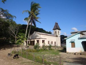
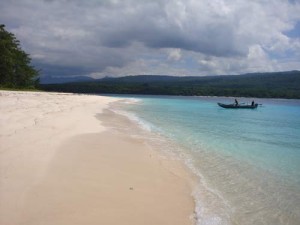
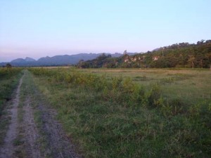
TUTUALA CHURCH From the guest house, ride back downhill south past the school and a white church with its unusual steeple, the Jaco island turnoff is on the left just past the church. 8,23’43.00 S 127,15’18.00 E. As the elevation at this point is 360 metres it is an easy ride down to the island but a hard slog back up with heavily loaded bikes. Two options if you are going in for a day trip only are. Leave everything at the guesthouse and walk, the distance in and out is approx 16kms. This can be done in a long day including a visit to the cave and a quick boat trip to the island, which is a great change from peddling. The second option is to unload the bike at the guest house and go on the empty bike. There is a beautiful small low priced eco resort with dining facilities at the beach so no gear is needed if you decide to stay overnight. There are few visitors through the week but I am told it gets busy at weekends. TL. and proceed south downhill, where there is one climb after crossing the creek, the rest is downhill on a reasonable sealed road that ends at a beach track and beautiful sandy palm lined beach with excellent diving, although the currents can be quiet strong. This spot is the eastern tip of Timor. The eco resort is at the very end of a short track to the north beside a beautiful palm fringed beach, a dugout canoe or local fishing boat with a small outboard is a short walk south, the fishermen take visitors the one kilometre over to Jaco Island and leave them to enjoy the island, nobody lives on Jaco and there is no camping, on a calm day they will take you around the island to view the beaches. JACO ISLAND BEACH “This really is an undiscovered tropical paradise” Zero trip meter at the Tutuala church with its interesting steeple, and return eight kms back west, along the plateau road to the turnoff to the south of the lake. Very few travellers use the route ahead as it is only passable on foot or cycle and muddy after rain, so the alternative is to return along the road you came out on and turn left after Bauro then it is then an easy 10 kms ride south to Lospalos. TL. just east of Mehara 8,23’47.00 S 127,11’54.70 and ride south downhill on a narrow sealed road to the grassy floodplain of lake Iralalaro, then past some rice fields and small huts near the lake on the right. The Paitchau Mountains ahead are a densely forested wilderness, part of the Nino Konis Santana National Park. This park covers 68,000 hectares of land and 55,600 hectares of marine environment.
PAITCHAU MOUNTAINS |
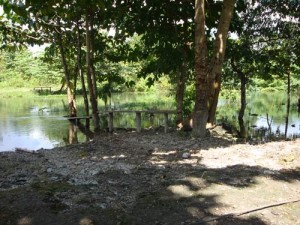
At 16.5klms from Tutuala the road turns left where it is blocked by the fast flowing Irasiquiru River, this river is the outlet of Lake Iralalaro.
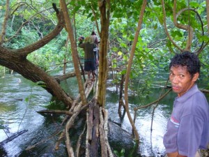
”You are now in the “crocodiles lounge room” 8,27’39.50S 127,09’51.80E . We saw only one crocodile. Some maps show a track back about a kilometre leading south, and although this looks like a way around the river, take note it just ends in the rainforest. Just downstream is the remains of a wooden bridge washed up on the east bank, testament to the amount of water that sometimes flows out of the lake. (As of late 2017 the wooden footbridge was back over the river, it was partly submerged but a motorbike rider just managed to wheel his machine across. People from Malahara [the next village] fish and farm this area, so they can probably be contacted by yelling, and if this doesn’t work climb the broken fence on the left and walk downstream through the bush into their vegetable gardens and ask for assistance to cross the river. Be prepared to negotiate a fee. Downstream through the gardens and jungle is a tiny rickety 200mm wide bamboo footbridge lashed to saplings with lantana vine just above the fast flowing crocodile river . GUIDE CARLITO AT IRASIQUIRU BAMBOO BRIDGE Unpack your gear as everything needs to be carried over the fence through the gardens, rocks and jungle to the bridge, after crossing the river they will take you out through the jungle to the road on the other side. Ride south west approx 3 klms toMalahara. There is a small guest house on the left side of the road overlooking the lake.
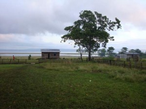
LAKE IRALALARO The locals speak of a whirlpool and waterfall where the Irasiquiru river disappears into the mountains. We hired a local guide and hiked through thick rainforest up over the foothills and down to the whirlpool, however recent heavy rains had flooded the river to a level where the whirlpool and waterfall were not visible. Some of the guides in this area are Falintil veterans who spent years up in the Paitchau trackless mountains, even hiding their commander Xanana Guzmao from the Indonesians in a cave. They can take you over these mountains and down to the south coast, or on a weeks trek through this wilderness. The Malahara cheifis name is Acacio Da Silva Phone +67077255266 however he may be difficult to contact. The Norwegian government has funded their engineers to design an environmentally friendly hydro electricity scheme, with a tunnel through the mountains and an underground power station near the Timor Sea. As the lake is more than three hundred meters above sea level, and receives most of the Lospalos plateau water runoff there is potential to provide clean power for most of the year Extensive research has failed to solve the mystery of where the water actually goes, although fishermen have reported that under certain conditions there are sometimes patches on the surface of the Timor Sea south of the mountains.
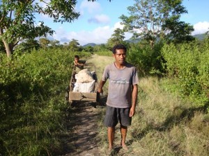
Motorbikes are the only vehicles that can reach this area from Lospalos, so all goods must be carried on foot or pushed and pulled in small two wheeled carts.
LOCAL HAULAGE MALAHARA Zero trip meter in Malahara and travel south west the track is rough and muddy, many sections must be walked, at 4 klms take the right fork then ride through Maupitine, this is about the limit of 4WD motor travel from Lospalos, ride west on an incredibly broken bitumen road (speed=7 kph ) over the Fuiloro plain to Lospalos at 19 klms As Lospalos is situated at a crossroad so you will now need to decide whether to ride south to Lore on the south coast then through the rain forest near the coast to Illioma, which is a very interesting but difficult and hazardous section, or take the safer and easier ridge road to Illiomer where the road winds up and down the hills and has great views of the Timor Sea. If returning via Lautem to Baucau ride north out of town over the temporary Baily bridge then nine nine klms across the plain to the Bauro crossroad, TL. = west, once off the plain the road then winds down through beautiful hillside vegetable gardens north to the coast. If riding via the main road that follows the ridges to Illioma go to the north end of town, turn left and travel west. The Lore road goes south via the right road at the statue in the roundabout at the bottom end of the main street. Lospalos being the largest town in the far east provides most services. In September 2009 an ANZ bank ATM was installed at the Hotel Roberto Carlos just south of town. Check with ANZ main office to see that it is working before leaving Dili, as the nearest ATM is a three hour bus ride away in Baucau.
|
